

The Earth – and everything on it
Geographic representation of the Earth's surface with existing and planned infrastructural elements makes essential part of all of our projects. Combination of extensive databases, professional software, knowledge and experience makes spatial planning our specialty.
Resources:
- Georeferenced high resolution satellite images for required locations
- Georeferenced county zoning plans
- Refined Shuttle Radar Topography Mission data converted into height contour lines of required height resolution; 5m, 10m, 20m (WindPRO)
- CLC land cover maps of Europe
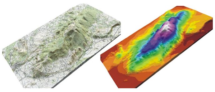
Services provided:
- Georeferencing, rectification and projection transformation of raster data of any format and purpose (topographic maps, aerial photos, zone plans, cadastre…)
- Vectorization – forming vectors from raster data (borders, roads, other infrastructure elements, height contour lines)
- 3D terrain visualization with height, slope, insolation and land cover assessment (ArcGIS)
- 3D objects visualization (Google SketchUp)
- Presentation of georeferenced vector and raster data in Google Earth (topographic maps, height and slope graded maps, cadastre, 2D and 3D objects)n
- Visibility and zone of visual influence assessment
- Animation and virtual walk

